CHC Nav i93
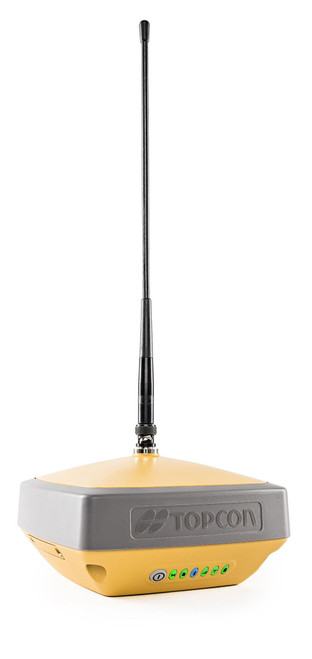
An exciting addition to our product basket, the CHC Nav i93 visual rover. The CHC Nav i93 features tilt compensation, a dual camera with visual features, and both UHF and 4G internal modems. The tilt function initialises in seconds, with a straightforward and safe calibration process – using tilt allows us to work in harder to reach areas without putting ourselves or our kit at risk.
The visual features include visual survey and visual stakeout – these advanced features mean that a complete beginner can have a simple understanding of their application. The i93 uses its photogrammetric algorithms to carry out visual surveys in signal obstructed and hard to reach areas.
The i93 is 100% proofed against condensation, and tracks 1408 channels across 5 different constellations. It is equipped with a 1.1” OLED Display which provides tracking, battery, Bluetooth and radio information. It also has a battery life of up to 34 hours.
The i93 is compatible with CHC’s Landstar 8 software. Landstar 8 is an Android based software which leaves no stone unturned. All features (including the premium ones) come as standard, without the need to pay to unlock features. Landstar 8 is compatible with a plethora of well-known and non-proprietary file formats such as AutoCAD DWG, AUtoCAD DXF, LandXML, CSV and TXT.
Tilt functionality
Using tilt allows us to survey in harder to reach areas, or areas which may not be safe for us or our equipment, whilst maintaining high level accuracy. The internal IMU sensor in the i93 is calibrated easily, in seconds and stays initialised for as long as your GPS does.
Visual survey
The visual survey feature uses the on-board camera to measure points. By taking a video and selecting the point we want to survey, the i93 uses its photogrammetric function to pinpoint co-ordinates in signal-obstructed and hard to reach areas. This allows us to gather coordinates under bridges and trees, and in those areas where we would usually require an optical instrument to measure.
Visual stakeout
Visual stakeout changes the way we set out points, lines and surfaces. Using visual stakeout overlays our data onto the live camera feed from the GNSS receiver, dramatically speeding up the stakeout process. Points can be displayed over a live imagine making setting out straight forward. When within a few metres of your selected point the camera view will change from the front camera to overhead, shooting directly down the pole for top accuracy.
GNSS Specifications
- Channels –1408
- Constellations – GPS, GLONASS, GALILEO, BeiDou, SBAS, QZSS
- Dimensions – 152 (D) x 81mm
- Weight – 1150g
- Status displayed / Panel – 1.1” OLED display, LEDs, Buttons
- External Power connector – Yes
- Battery Life – up to 34 hours
- Humidity – 100%
- Environmental rating – IP68
- Cellular Modem – Yes
- UHF Modem – Yes
- Tilt Functionality – Yes
- Maximum tilt angle – 60 degrees
- Imaging Functionality – Yes
- Camera sensor – Dual, 2 & 5MP
- Warranty – 2 years
Controller Specifications
- OS – Android 10
- Display size – 5.5”
- Input – touchscreen and keypad
- Connectivity modules – Bluetooth and cellular
- Environmental rating – IP67
- Storage – 32GB
- RAM – 3GB
- Size – 224 x 80 x 15.4mm
- Weight – 345g
- SIM card type – Nano-SIM
- Battery life – up to 14 hours
Key features
- Long 36 hour battery life
- UHF Radio and Network
- 5 constellations
- Tilt compensation
- Visual features
- Dual camera
Kit includes
- CHC Nav i93 GNSS
- HCE600 5.5” field controller
- Telescopic GPS pole
- Pole clamp and controller cradle
- Landstar 8
- UHF antenna
- 12 month unlimited RTK subscription and SIM card
- Carry case
Ideal for:
- Utilities
- Civils
- Quantity surveyors
- Setting out


 Yes
Yes  No
No