Topcon MC-Mobile
Topcon MC-Mobile is a flexible 3-in-1 solution that allows contractors to measure, design and build using one connected system. Designed for compact construction equipment, it helps operators complete smaller earthmoving projects with less reliance on separate surveyors or grade checkers.
The system can be used to survey a site, create or load a digital design, control the machine and check the finished work. Its modular hardware can also be moved between machines or used on a survey pole, helping you get more value from the same equipment.
Cab Kit Components
- GX-10W – Running Android v12 operating system for Pocket3D
- GR-i3 GNSS Receiver or ATP1 Machine Prism
- Topcon LN-150 3D robotic laser
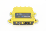
- MC-X1 (Used to link the system and provides a BT connection for LPS)
- Optional radio for use with machines on base
Wiring Kit Components
- 4 x TS-i4 sensors (Inertial sensors, slope and rotation. Optional 5th sensor for slew)
- Wiring harness (X Series specific)
- Window mount for screen
- GNSS Receiver cables
- Tilt sensor CAN cables
- Sensor weld plates
- GPS antenna mounts (posts or boxing ring mounts)
- Radio whip antenna (when using radio)
Installation and Calibration
MC-Mobile has been designed to be simple to install and calibrate.
During setup, the installer measures the machine and attachment, sets up the GNSS receiver or prism and calibrates the required sensors.
The GNSS receiver or prism provides the machine’s position, while the TS-i4 sensors measure the movement and angle of the machine and attachment. The system then calculates the position of the bucket edge, blade or selected point.
MC-Mobile provides 2D and 3D guidance.
When sharing the portable MC-Mobile equipment between machines, each machine must:
• Have the correct machine-side equipment installed.
• Be fully measured and calibrated.
• Have its own saved machine configuration.
• Be compatible with the portable tablet and positioning equipment.
Typical Applications
Ideal for building pads, car parks, driveways, landscaping, drainage, sports facilities and general small-to-medium earthmoving projects.
Topcon Sitelink3D Online Data Transfer and Remote Access
Sitelink is Topcon’s online, cloud-based data management and remote access platform.
To access Sitelink, users must first create a free MyTopcon account at www.topconpositioning.com.
Topcon machine control systems are supplied with a Topcon data SIM. Once activated, these SIM cards enable network connectivity and can be paired with Sitelink for remote access and file transfer (for more info on this, contact us). Sitelink connectivity is currently run on a per-point basis. Points can be purchased from our website and activated on My Topcon. Once Sitelink points have been activated, the Sitelink App will be accessible, and a unique support desk connection number will be provided.
Once your account is set up, data loaded to the online site can be synchronised to all Topcon machine control and Field Controllers. Tasks can be set for specific regions or individual machines, with updated design synchronisation, so everyone has the same data, thereby avoiding delays or costly mistakes.
Topo survey data can be recorded by individual machines or recorded on a layer set to be updated by all machines. This data can then be synchronised to Sitelink and downloaded for quality control or used to monitor progress.
Sitelink3D supports a range of Topcon, CAD and industry-standard design formats, including:
- TP3 – Topcon project file.
- TN3 – Topcon surface file.
- LN3 – Topcon linework file.
- GC3 – Topcon localisation file.
- DXF.
- DWG.
- LandXML.
- CSV.
- TXT.
For further information about Sitelink3D, account creation and Service Points, please see: [LINK]
Software Features:
- 2D or 3D machine guidance.
- Create, upload and use digital designs.
- Use the same equipment for machine guidance, site layout and grade checking.
- Automatic control is available for certain compact track loader and skid-steer attachments.
Current recommended versions include:
- 3D-MC on GX-10W: v15.5.1.29
- MC-X1 controller firmware: v2.3.8
- GR-i3/GR-i3F main firmware: v3.00 or newer
- TS-i4 firmware: v3.0.2
Approved versions can change as new updates become available. For confirmation of the correct software and firmware bundle for a particular machine, please contact us.
Available Configurations and Upgrades
GNSS Positioning
A GNSS receiver can be fitted to the machine to provide 3D positioning and guidance.
The receiver and tablet can also be removed and used on a survey pole for site layout, measuring and grade checking.
LPS Positioning
MC-Mobile can use a Total station and machine-mounted prism instead of GNSS.
This is useful where satellite reception is blocked by buildings, trees or other site conditions.
2D Laser
Supported laser receivers can provide simple 2D height and slope guidance.
The available sensors and functions depend on the machine and attachment being used.
Automatic Hydraulic Control
MC-Mobile excavator systems provide 2D or 3D guidance only.
Important Notes
• MC-Mobile systems use the MC-X1 controller.
• GX-10W wireless tablet.
• GNSS, LPS and 2D positioning options are available, depending on the machine.
• The number and position of the TS-i4 sensors depend on the machine and attachment.
• Automatic control is only available for approved compact machine attachments.
• Excavator systems are indicate-only unless upgraded to MC-Max.
• Portable equipment can be moved between machine operation and site-measuring tasks.
• Each machine must be properly measured, installed and calibrated before use.


 No
No  Yes
Yes